NASA satellites and sensors constantly take the pulse of our planet, measuring how Earth changes by the day, season, year, and decade. Researchers and resource managers analyze those measurements and apply them on local and regional scales to better manage things like our food and water supplies, health, safety, land use, and ecosystems. NASA data is also used by other government agencies to help with responses to natural disasters and emergencies around the country and the world.
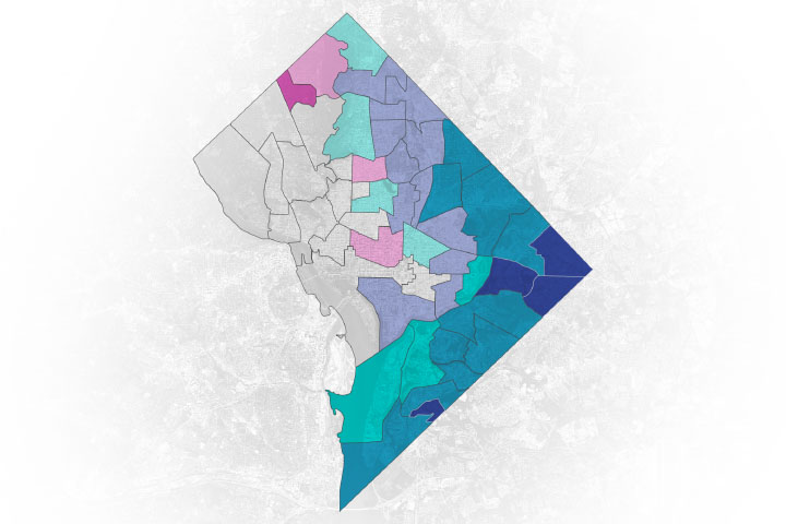
New research shows that neighborhoods in Washington, D.C., with more people of color are exposed to more air pollution and have higher rates of disease.
Published Nov 9, 2021Image of the Day Atmosphere Land Life Human Presence Remote Sensing
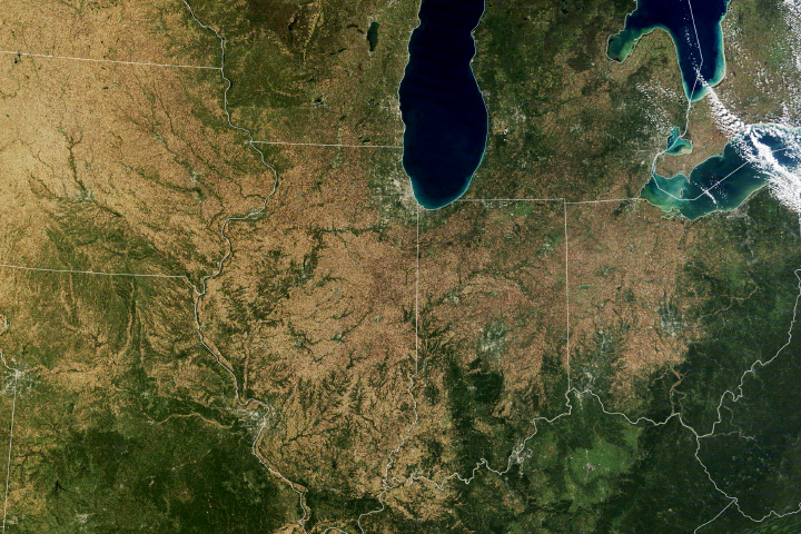
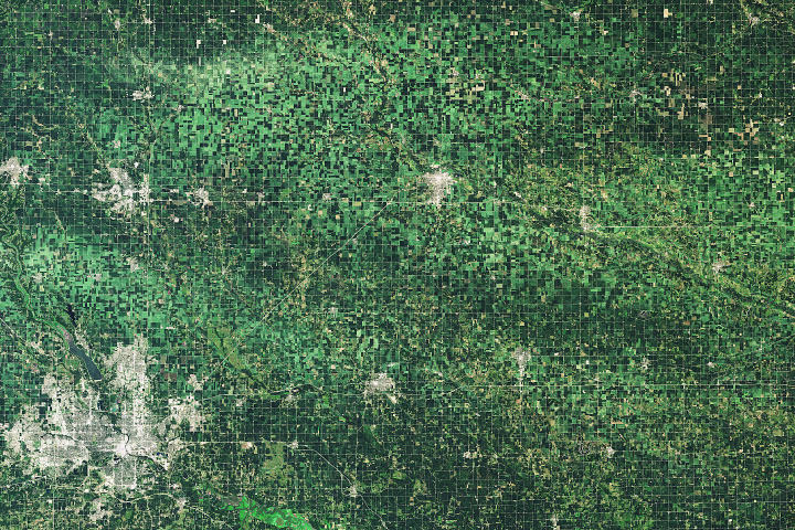
More than one third of the world’s maize (corn) crop is grown in the United States, and the largest share comes from a swath of land across the Midwest.
Published Nov 4, 2021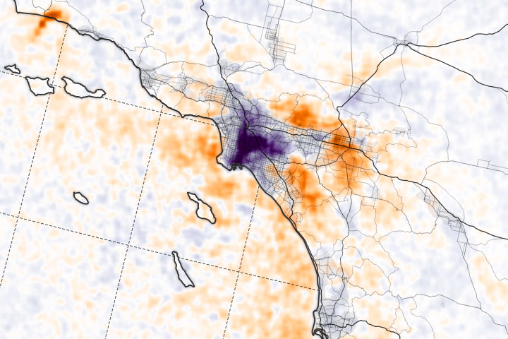
Satellite observations of nitrogen dioxide near key U.S. ports suggest that increased shipping activity and backlogs may be affecting air quality.
Published Oct 27, 2021Image of the Day Atmosphere Dust and Haze Human Presence Remote Sensing
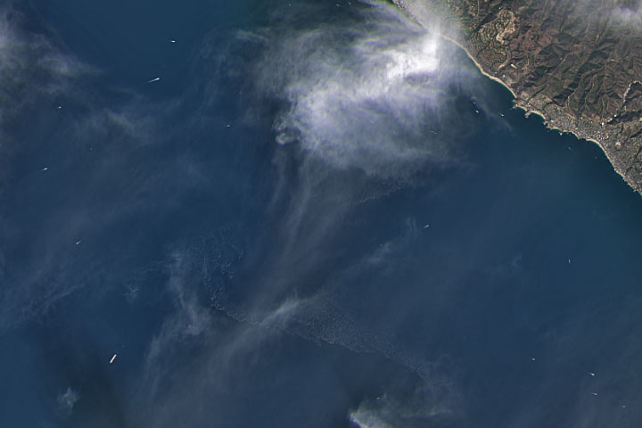
Satellite imagers can make oil spills easier to detect in open water.
Published Oct 7, 2021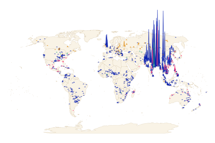
The proportion of the world’s population exposed to floods grew by 20 to 24 percent—ten times greater than what previous models had predicted.
Published Sep 27, 2021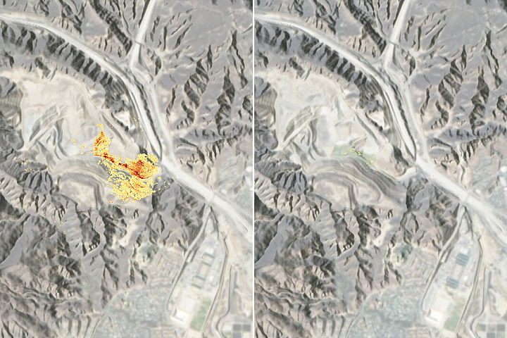
Using precision instruments and new mapping and machine-learning tools, a research team has been pinpointing sources of the greenhouse gas.
Published Sep 9, 2021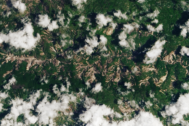
A break in the clouds offered satellites a view of hillslopes that slid away during the magnitude 7.2 temblor.
Published Aug 16, 2021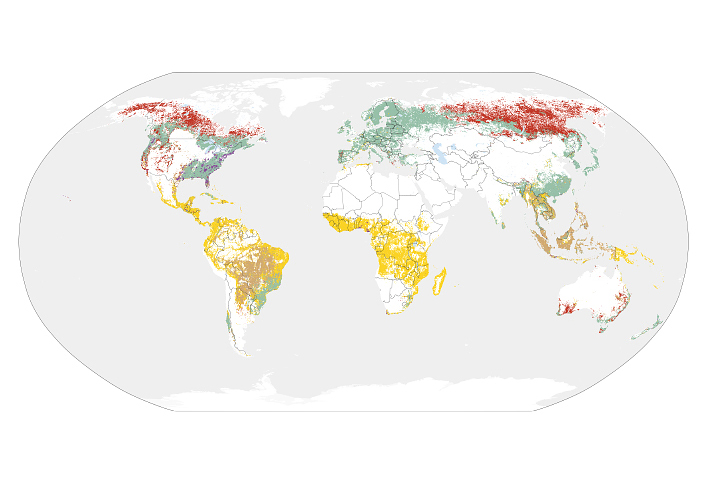
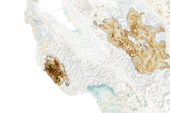
Using satellite data from the past two decades, scientists are starting to pinpoint which crops and farming styles have lasting impacts on forests.
Published Aug 11, 2021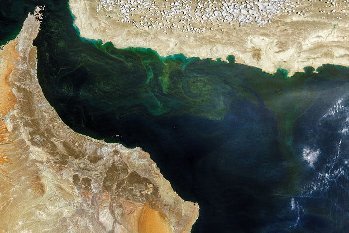
How can snow cover on the Himalayas influence the species that thrive in the ocean a thousand kilometers away?
Published Aug 5, 2021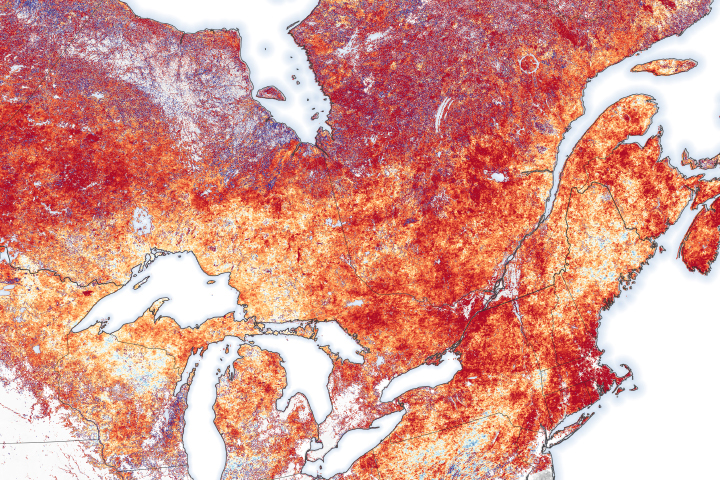
Researchers used field observations and remote sensing data to map the spread of the bacteria-carrying ticks in central and eastern Canada.
Published Jun 25, 2021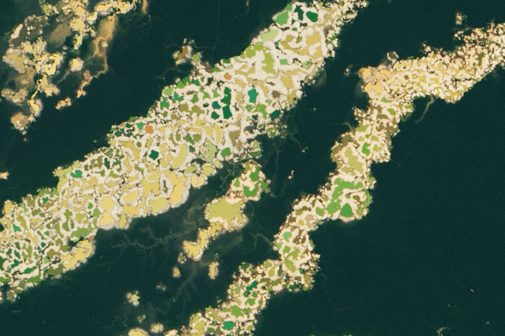
Researchers have created a satellite-based tool to help officials identify new activity.
Published Jun 16, 2021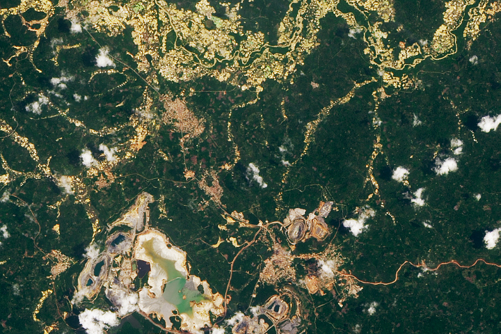
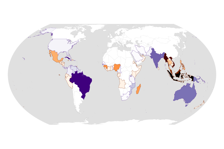
In the past decade, unregulated artisanal mines accounted for more deforestation than industrial mines.
Published Jun 15, 2021
For the second year in a row, drought has overtaken much of the United States from the Rocky Mountains to the Pacific Coast.
Published Jun 11, 2021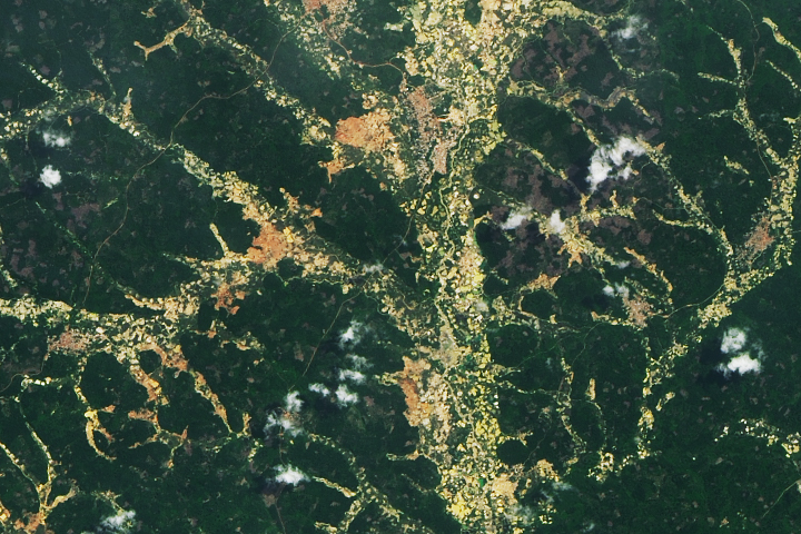
Researchers are using satellite data to locate small mines that can cause long-term damage to forest communities and human health.
Published Jun 2, 2021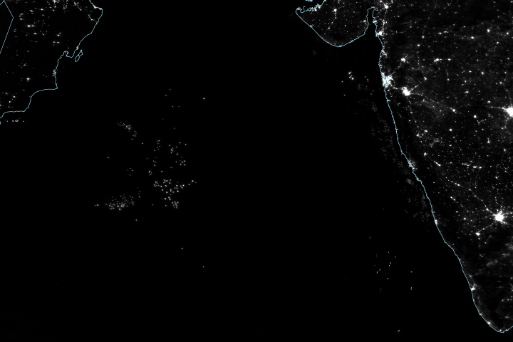
Researchers have found another use for night lights imagery: tracking unregulated and under-reported fishing.
Published May 17, 2021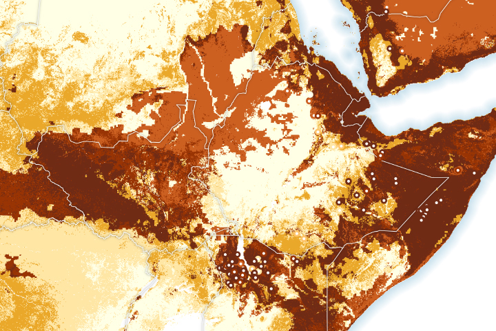
Researchers can predict locust breeding locations up to nine weeks in advance.
Published May 14, 2021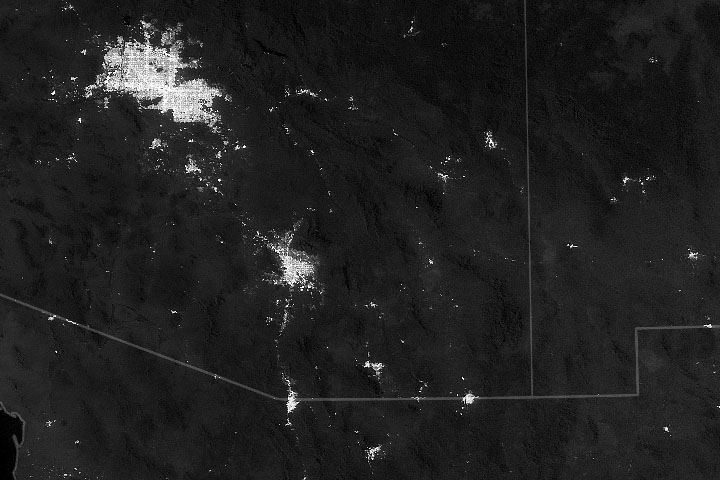
Using satellites, scientists are starting to better understand the specific sources of urban light pollution.
Published May 3, 2021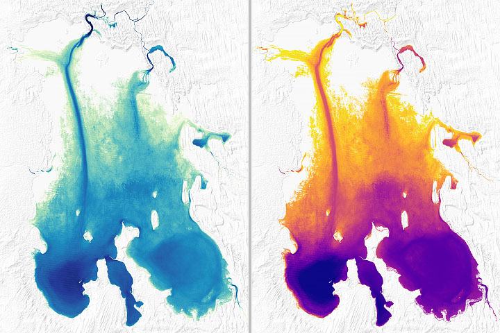
Researchers are using ICESat-2 elevation data to create bathymetry maps of shallow lakes in the remote desert.
Published Apr 27, 2021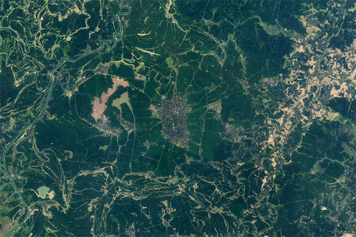
Scientists harness satellite data to help farmers use less water in India, Pakistan, and Bangladesh.
Published Apr 21, 2021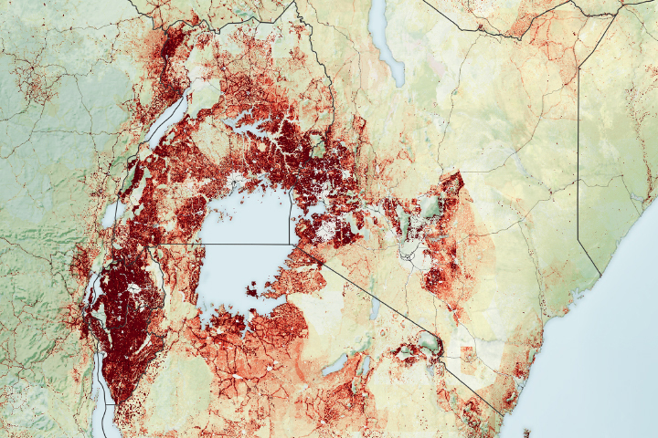
Satellite data show electricity access increased in many urban populations but decreased in some rural areas from 2014-2019.
Published Mar 22, 2021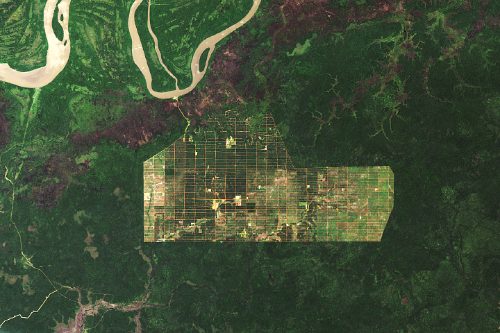
While the region has seen less deforestation than other parts of Indonesia, large-scale clearing is still evident.
Published Mar 9, 2021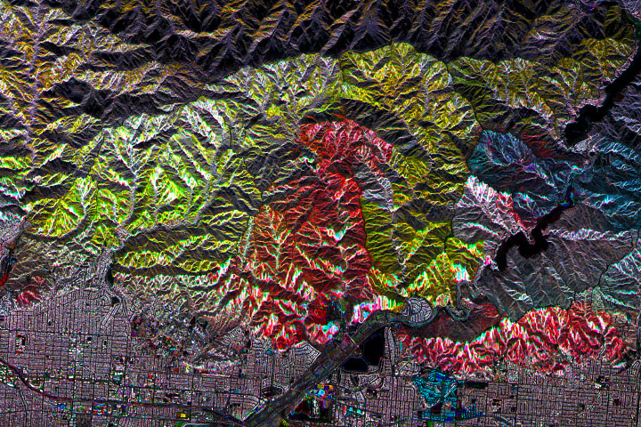
Scientists are using radar data to decipher where and how well landscapes recover in the years after major fires.
Published Feb 6, 2021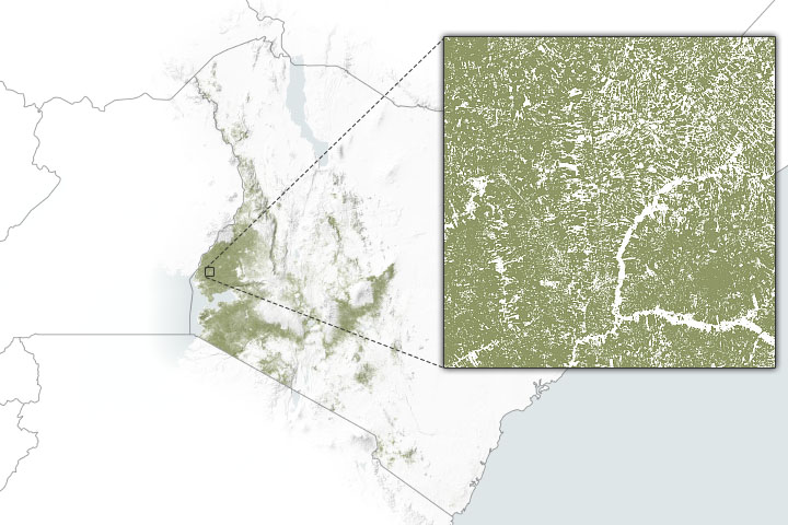
Cropland masks and other environmental data can help agriculture agencies pinpoint where support is most needed.
Published Jan 25, 2021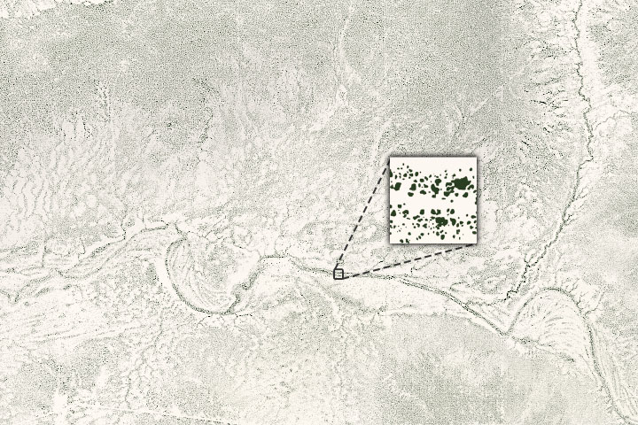
An international team of scientists has used artificial intelligence and commercial satellites to identify an unexpectedly large number of trees spread across arid and semi-arid areas.
Published Dec 7, 2020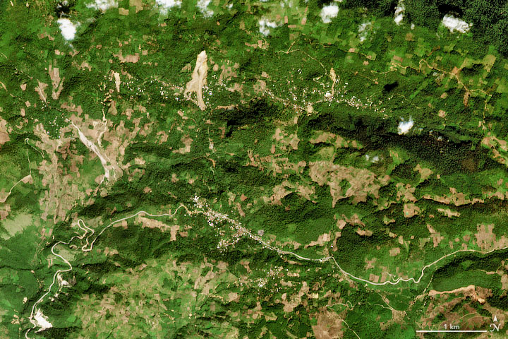
After severe hurricanes dropped torrential rain on Guatemala, Nicaragua, and other countries, NASA researchers worked to map potential landslide hazards.
Published Nov 18, 2020Image of the Day Land Severe Storms Human Presence Remote Sensing
Analyzing subtle differences in near-infrared and shortwave-infrared light from the landscape, scientists can provide some measure of the severity of wildfire burns.
Published Oct 14, 2020Image of the Day Heat Land Fires Human Presence Remote Sensing
While the rate of losses has declined, the ecosystems are still threatened and are facing more environmental stress.
Published Aug 25, 2020Image of the Day Land Life Water Human Presence Remote Sensing
A line of thunderstorms with hurricane-force winds caused widespread damage to crops.
Published Aug 20, 2020Image of the Day Atmosphere Land Life Severe Storms Human Presence
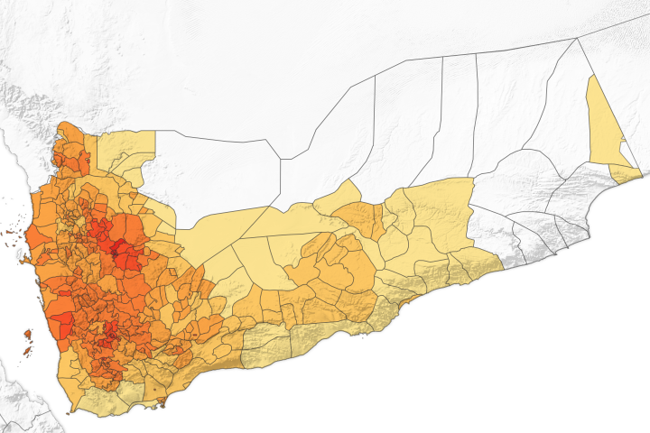
Researchers are using satellite and ground data to forecast the risk of cholera in the country, which has consistently experienced cases since 2017.
Published Aug 12, 2020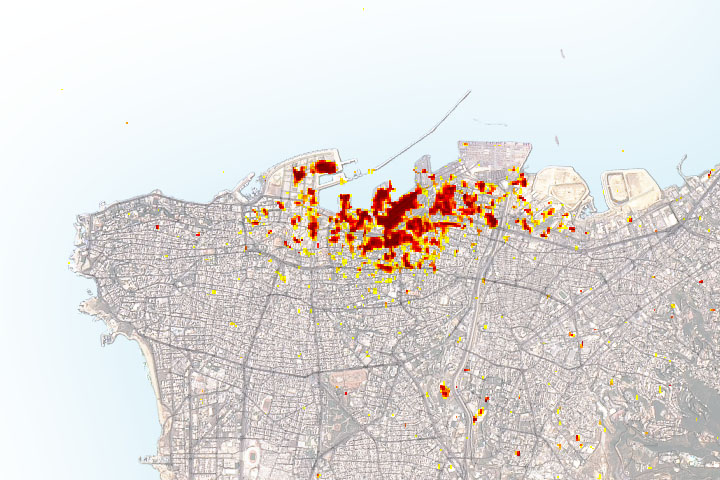
Radar imagery of ground surface changes could help with efforts at disaster relief and recovery after the explosion.
Published Aug 11, 2020